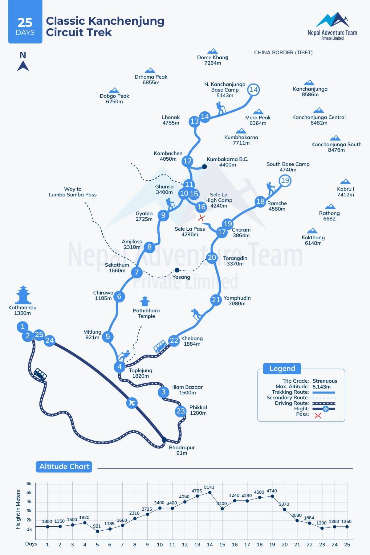
How Does a Trekking Map Enhance Your Kanchenjunga Circuit Trek?
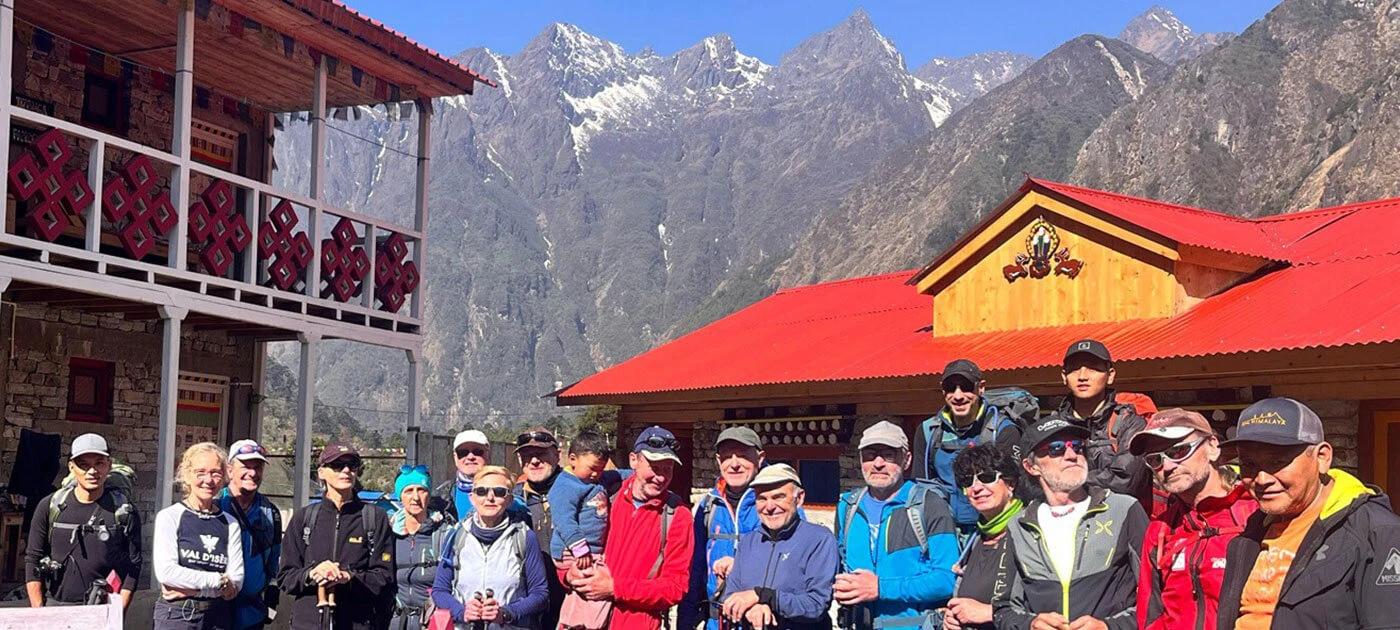
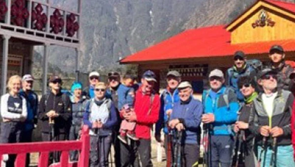
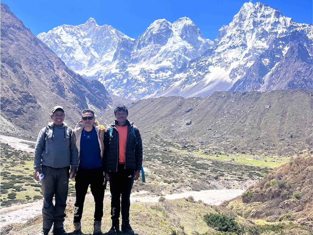
As the Kanchenjunga solo trek is not possible, requiring a seasoned Nepal trekking guide for every hike in the Kanchenjunga region to assist trekkers in navigating trails and managing all logistics, you can walk from verdant subtropical forests to rugged landmarks without stress. Although a local guide is familiar with the main trails, alternative routes, and weather predictions for various locations, it is also helpful to have a trekking route map for the Kanchenjunga Circuit trail elevation profile, depending on the itinerary.
The top reasons you need a Kanchenjunga Trekking Map before you go are below:
How does a Kanchenjunga Trail Map guide your trek?
It may be confusing to navigate trails to reach high and remote settlements such as Ghunsa, Khambachen, Lhonak, Se Le High Camp, Chairam, and Torongding, as the Kanchenjunga trail is less established than other popular treks like the Everest Base Camp Trek and Annapurna Base Camp Trek. The Kanchenjunga Circuit Trek Route Map helps you navigate the right path, identify breathtaking vantage points and highlights of the journey, and avoid getting lost, especially in the dense forests and secluded mountainous terrain.
What Makes a Map Essential for Itinerary Planning in Kanchenjunga?
The Kanchenjunga Circuit Trekking map helps to plan an efficiently handled itinerary with a vivid outline of the region's difficult mountainous geography, including high alpine passes (elevations above 4000 m), strenuous sections, and isolated settlements. After observing the visualized routes on the map, hikers can determine a pausing spot for rest and acclimatization, as well as estimate daily distance and walking hours.
The Kanchenjunga trails are less established, with fewer settlements along them. The Kanchenjunga Circuit Trek Route Map is essential for such trails with minimal development and a lack of proper trail markings, ensuring a safe and more enjoyable adventure.
While choosing the Nepal Adventure Team itinerary, preparation for prolonged walking will be easier with the aid of the Kanchenjunga Circuit trail elevation profile, as it makes you understand the elevation changes and makes you alert for unpredictable weather and altitude-related challenges.
Hence, a detailed map of the Kanchenjunga Circuit allows trekkers to enjoy nature without undue stress and with Informed, Knowledge-Based decisions. Starting a journey with guided sightseeing in Kathmandu, you can have the most incredible memories on the Kanchenjunga trails as the map guides you perfectly.
Why Is Highlighting Key Landmarks and Villages Vital on the Kanchenjunga Trek Map?
Before reaching the Popular bucket-list destinations such as Pangpema (5143 m) and Oktang (4730 m), you will pass through historically and culturally significant villages and vantage points like Gyabla, Ghunsa, Khabachen, and Lhonak. If you have a map like the Kanchenjunga route guide, you can understand the surroundings as well as easily pass the high mountain passes like Sinion La Pass (4646 m), Sele Le Pass(4480 m), and Mirgin La Pass (4645 m). From here, you can see a panoramic scene of Mt. Kanchenjunga, Kabru, Jannu, etc.
You will find marked locations on Nepal Adventure Team’s Kanchenjunga Circuit Trekking map, guiding walking in remote areas with the enhancement of the entire experience, including acclimatization and cultural immersion in quaint settlements of various ethnic groups. Hence, the detailed Map for the Kanchenjunga Circuit offers you the opportunity to make a deep connection with nature and tradition in the wilderness of the Kanchenjunga region.
Is a Trek Map That Supports Altitude Awareness and Acclimatization Crucial in Kanchenjunga?
The Kanchenjunga Circuit Trekking Map also includes a trail elevation profile, providing detailed information about altitude gain throughout the trip and helping hikers to identify high-elevation spots for the awareness of high-altitude acute mountain sickness. Trekkers can plan for acclimatization stops and be alert while walking, identifying threat-prone areas. Gradual ascents and tactical elevation planning allow trekkers to have joy in a peaceful environment with magnificent views. Classic Kanchenjunga Circuit Trek becomes one of the most exhilarating off-the-beaten-path Nepal Treks while using a map for elevation guidance and considering health.
How does a Kanchenjunga Circuit Trekking map enrich a Self-Guided or Independent trek?
Since the Kanchenjunga’s parts are remote, a seasoned trekker with prior experience may accomplish this hiking independently with the support of a Detailed Map for the Kanchenjunga Circuit. A map with an elevation profile builds your confidence to discover the region independently and helps you handle altitude-related challenges and other obstacles more effectively and safely. You do not need to worry about fines or delays, as the map displays the locations of checkpoints, supporting you to remain within legal boundaries.
Hence, using a map means enhancing the entire journey with a better appreciation of stunning, diverse landscapes, cultural immersion, and a bond with locals. However, Nepal’s rules and regulations do not allow you to trek alone in any destination in Nepal, ensuring your safety in danger zones where floods, snowfall, heavy rainfall, etc., may bring challenges on your trails.
What Types of Kanchenjunga Circuit Trek Maps Are Available?
Among the different types of Kanchenjunga Trail Maps, it’s your preference to choose the best one that provides you with the best guide for trail navigation, logistics, and awareness of elevation changes. According to your itinerary of the Kanchenjunga Circuit Trek, select a map, ranging from traditional printed maps to more modernized GPS tools, Offline map files, and Nepal-based hiking apps. The chosen maps determine how much joy you will get without facing obstacles. Each kind of Kanchenjunga Circuit Route Map assists you in staying alert at every step of the journey, with unique characteristics for different necessities.
Why Are Traditional Topographic Maps Still Valuable on the Kanchenjunga Trail?
To explore the different portions of the Kanchenjunga, including the most captivating Kanchenjunga Conservation Areas, with trustworthy guidance by using classic paper topographic maps. As you do not need a battery or electricity and have good access to the internet, you do not have to skip essential information about any places throughout the hike: Trekking companies design a detailed map, clearly displaying elevation profiles, rivers, glaciers, peaks and mountains, woodland sectors, terrain elevation markings, and villages that are along the trails.
The printed Kanchenjunga Circuit Trek maps have more significance in the secluded areas where GPS signals are lost and internet connections often fail. Before starting an odyssey in remote areas of far eastern Nepal, ensure that your company provides thoroughly detailed, long-lasting editions and weather-resistant maps that suit both beginner and seasoned hikers.
What Are Digital Maps and Mobile Apps for the Kanchenjunga Circuit?
Considering trekking challenges in the Himalayas of Nepal, several digital tools, such as Gaia GPS and Maps.me, have taken place, providing a hiker with detailed elevation profiles and downloadable digital route maps. While venturing into the longest and most remote route, like the Kanchenjunga Circuit Trek, a digital map might be easier for navigation as it provides real-time GPS tracking. Since a digital and detailed map for the Kanchenjunga Circuit grants precise and current route details, you can triumph over hurdles on trails due to strenuous topography and changing climate.
In remote or high-elevation settlements, developed apps guarantee you are on the correct route using offline tools, securing your safety, although navigation signals are unavailable there. You do not feel alone while not connecting to your family members and loved ones, as the digitalized map almost nicely guides you. Those who are looking for a more secure journey can use these kinds of mobile apps and digital maps while walking through the diverse terrain of the Kanchenjunga region.
Are Official Trekking Route Guides Useful for the Kanchenjunga Circuit Trek?
The official Kanchenjunga trekking route guide, provided by a local travel company or provincial tourist office, is beneficial for completing the Kanchenjunga Circuit trekking, as the well-tailored guide includes detailed trail information for the hiking. Trekkers find it easier to plan for the hike while getting heritage information and route logistics together with recommended itineraries, precautionary advice, elevation profiles, trekking gear, and Kanchenjunga trail highlights. With the support of a reputable travel agency, such as Guide Trekkers, you can make it to the base of Mt. Kanchenjunga without suffering. A legitimate trekking route guide is perfect for hikers seeking current directional assistance and a reliable, enriching experience for the entire adventure.
How to Choose the Kanchenjunga Circuit Trekking Map?
Wise preparation also includes selecting the right map according to your detailed itinerary. Therefore, ensure that your map is well-designed and has crucial components for discovery in a profound way and safety during the hike. While choosing the best map for the Kanchenjunga Circuit Trek, ensure that the map has the following things:
Why should the Kanchenjunga Circuit Trek Route Map include Accurate Topography and Scale?
It is crucial to consider the accuracy of the map, as a map missing correct elevation and scale information is incapable of helping adventurers recognize peak outlines and terrain elevation changes. Before embarking on the journey, ensure you have everything necessary for trekking, including the Kanchenjunga route guide.
A defective map makes it challenging to plan daily trail coverage and walking times effectively, which may result in insufficient readiness and safety risks on the path. Hence, a quality Kanchenjunga Circuit Trek map must ensure trekkers’ safety and comfortable travel arrangements with the identification of difficult ascents and some technical descents.
Are Updated Trail Conditions Important When Choosing a Trekking Map?
Most Kanchenjunga trails are poorly marked, consisting of landslide-prone areas. Therefore, ensure that you have chosen a map with updated path conditions to avoid challenges like returning to Kathmandu or selecting a more dangerous alternative way due to the blockage of the selected Kanchenjunga route. When you know the trail shifts because of maintenance or other reasons, you can prepare yourself for safer hiking. Hence, be wise and escape from the outdated maps that may send you in the wrong direction in secluded terrain.
How Does an Elevation Profile Help on the Kanchenjunga Circuit Trek?
The Kanchenjunga Elevation profile helps to prepare you mentally and physically since it not only provides elevation changes but also a geographic display to help you identify threat zones. Therefore, ensure that your detailed Map for the Kanchenjunga Circuit has accurate elevation information, and enjoy it to the fullest while trekking.
Why Are Village Names and Altitudes Important on a Trekking Map?
As accommodation and food are key to a successful adventure, trekkers should know the elevation of every village to plan overnight stays and acclimatization. You can walk with gradual ascents, preventing high altitude sickness when you have knowledge about settlements like Gyabla, Ghunsa, Khambachen, etc.
Do Route Variations Impact Your Kanchenjunga Trail Map Choice?
To make it easier to navigate the route, the chosen Kanchenjunga Circuit trekking map should represent whether you are starting or ending the trek, for example, north to south or moving along the circuit clockwise, depending on your itinerary. Guidance helps you with special permits, logistics, and preparation according to the weather.
How can a seasoned Nepal trekking guide help you with the right guidance on the Kanchenjunga Circuit Route Map?
Even if you could do the Kanchenjunga Solo Trek, you might have suffered from several problems due to a lack of knowledge about local places. A professional trekking guide in Nepal can help you comprehend the different stunning destinations and the predicted weather of particular areas. Since guides have many years of experience in the mountainous terrain consisting of strenuous sections, they can navigate trails according to the Kanchenjunga Circuit Route Map with self-assurance and clear direction.
Guide’s deep expertise in the region’s topography allows you to hike safely, as they know the route variations when the chosen route gets blocked due to natural disasters. Interpreting the Kanchenjunga trail elevation profile, they manage logistics, including accommodations, food, and acclimatization stops. Although the trails are less marked, a guide can help you cross highly risky areas before the unpredictable weather brings harsh circumstances. Hence, your journey becomes successful with a well-designed itinerary, the guide’s expertise, and a detailed map for the Kanchenjunga Circuit.
Conclusion
To sum up, a detailed map for the Kanchenjunga Circuit Trek is not only for accurate path guidance for trekkers, as it elevates the whole hiking experience with the guarantee of well-planned walking, safety, and adventure through diverse landscapes with the rich biodiversity of the Kanchenjunga region. Hence, the route is both demanding and rewarding; you just need to understand smarter choices, including maps and other logistics.
Nepal Adventure Team has never been unsuccessful in providing the best services, including providing a professional guide, local porter, or maps (printed or digital). Not only is the Kanchenjunga Circuit Trek a package, but we can also manage trips in different regions such as Langtang, Annapurna, or the Everest region. Therefore, hurry up to make your dream journey team with us. For further inquiries about the circuit or other regional trekking routes, you can contact us on WhatsApp or do email.
FAQs
What is the highest point of the Kanchenjunga Circuit Trek?
The highest point of the Kanchenjunga Circuit Trekking is Kanchenjunga North/Pangpema Base Camp at an elevation of 5143 m.
When is the best season to trek to the Kanchenjunga region?
Spring (March to May) and autumn (September to November) are the optimal periods of the year to embark on the Kanchenjunga trek, as they feature pleasant weather and moderate temperatures.
How difficult is the Kanchenjunga Circuit trek?
Kanchenjunga Circuit Trekking is moderate to strenuous trekking due to its remote topography, including steep ascents and descents.
Why do you need travel insurance for the Kanchenjunga Circuit trek?
As travel insurance works as a safeguard during the Kanchenjunga Circuit trek, we advise you to obtain it. You can save extra expenses on medical treatment in the event of an injury or helicopter evacuation above 4000 m.
What kind of accommodation and food are available on the trails of the Kanchenjunga Circuit?
Generally, you will find simple teahouses with common facilities, rooms with twin beds, and shared bathrooms on the Kanchenjunga Circuit route. Dal and Bhat are the most common foods throughout the journey, which consist of steamed rice, seasonal vegetables, salads, and tasty pickles.
Do you need to hire a guide and a porter for the Kanchenjunga Circuit Trek?
Hiring a professional guide is mandatory for the Kanchenjunga Circuit Trek. Nevertheless, you can also hire a local porter to enhance the journey, as a porter lets you walk freely by supporting you to carry a heavy load while the guide assists in navigating difficult sections.
What permits do you need to attain for the Kanchenjunga Circuit Trek?
You need to attain a TIMS (Trekkers Information Management System) Card, a Kanchenjunga Restricted Area Permit, and a Kanchenjunga Conservation Area Permit.